High Sierra Highlights: Road Tripping Yosemite, Mammoth & Hwy 395
There’s nothing quite like trading LA’s urban sprawl for granite peaks, alpine lakes, and wide-open skies. On a spring road trip from Los Angeles to Yosemite, Mammoth, and down the iconic Hwy 395, we set off in search of wildflowers, snow-dusted trails, and that perfect balance of adventure and quiet. With Tioga Road open, we were able to traverse Yosemite’s high country, enjoying the full stretch of the Sierra. This loop through California’s Eastern Sierra is quite literally a breath of fresh air—equal parts rugged and restorative. I like to call it: The Sierra Circuit. And it goes a little something like this…
Itinerary at a Glance:
Day 1: LA → Yosemite (Wawona Swinging Bridge, Tunnel View)
Day 2: Yosemite Valley (Waterfalls, bike ride, dinner in the park)
Day 3: Tioga Road → Mammoth (Soda Springs, Lembert Dome, Tenaya Lake, Mono Lake, Whoa Nellie Deli)
Day 4: Explore Mammoth (Crystal Lake, bike ride, sunset views)
Day 5: Mammoth → LA (Hot springs, bakery stop, BBQ, roadside adventures)
In this guide, I’ll walk you through an ideal 5-day itinerary, what to pack and how to get reservations/permits for Yosemite National Park for Summer 2025.
Day 01: Los Angeles to Yosemite Valley
Drive time: ~5.5 hours
Leave early to beat the traffic and maximize your time in Yosemite. Once you arrive, head straight to Wawona Swinging Bridge (not to be confused with another similarly named attraction in the Valley). This bridge is a true suspension bridge that gently sways as you cross it. It spans approximately 40 feet over the South Fork of the Merced River. This spot is popular for its serene setting and natural swimming hole. During the summer months, the river slows and warms, creating inviting emerald pools surrounded by smooth granite boulders, perfect for wading, swimming, or relaxing on the rocks.
There are two main trails to reach the bridge:
Forest Drive Trailhead: This is the shorter and easier route, approximately 0.6 miles round trip with minimal elevation gain. The trail is wide and mostly flat, making it accessible for families and casual hikers
Chilnualna Falls Road Trailhead: This option offers a slightly longer hike of about 1.4 miles round trip with around 70 feet of elevation change. The trail meanders through a pine forest and provides scenic views of the surrounding area
Both trails are relatively easy and suitable for most visitors. Dogs and bikes are not permitted on these trails, and there are no restrooms at the trailheads, so plan accordingly
As the day winds down, drive to Tunnel View for that iconic sunset over El Capitan, Half Dome, and Bridalveil Fall. Whether you're camping or staying at a lodge, settle in early, you’ve got a big day tomorrow.

Day 02: Explore Yosemite Valley
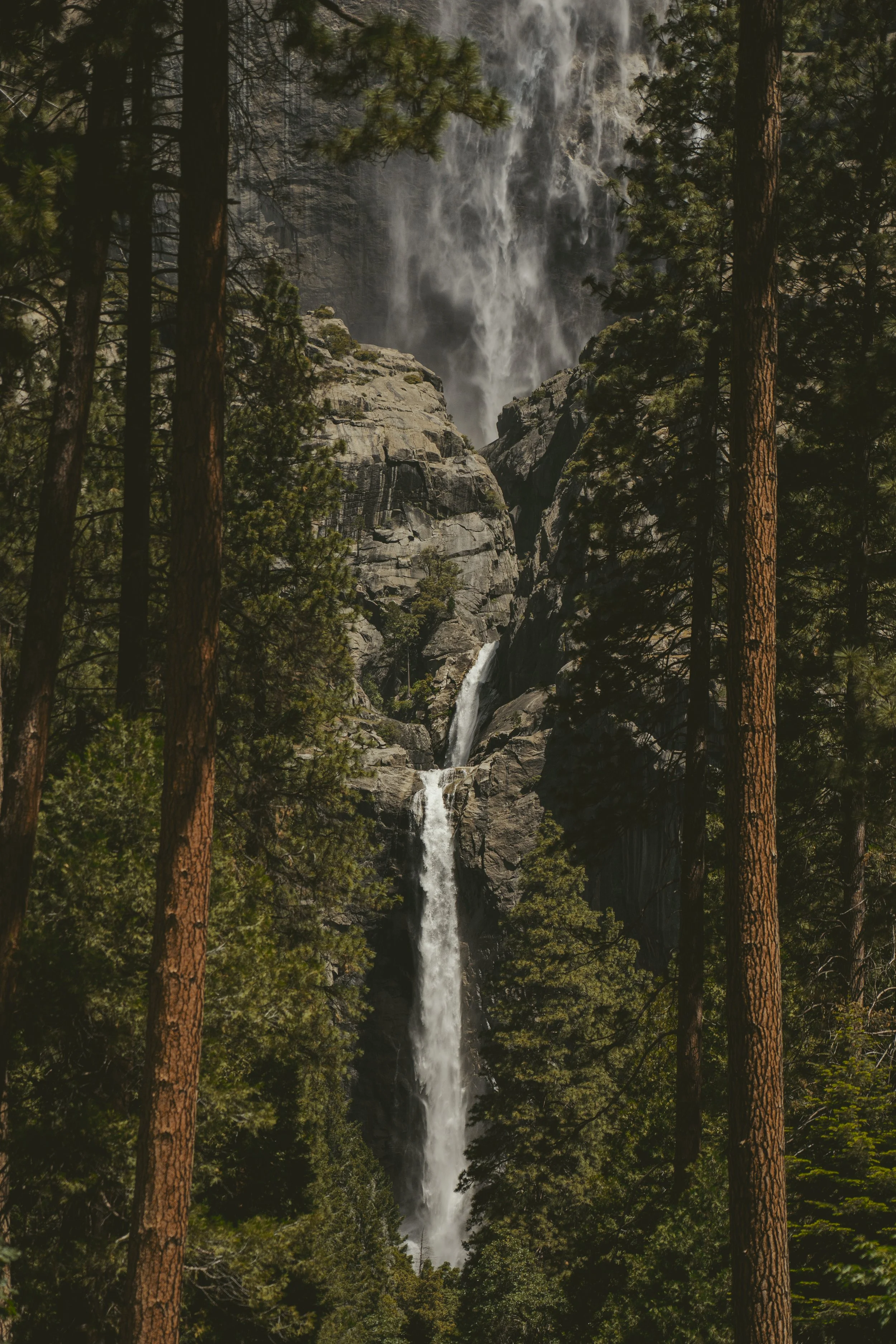
Yosemite Falls is an iconic centerpiece of the park, plunging a staggering 2,425 feet from the top of the Sierra cliffs down to the valley floor. It’s actually three waterfalls in one—Upper Yosemite Fall, the Middle Cascades, and Lower Yosemite Fall—each visible from different vantage points throughout the valley.
If you’re up for a challenge, the Yosemite Falls Trail is a strenuous but rewarding hike that climbs 7.6 miles round trip with over 2,600 feet of elevation gain to the top of the upper fall. Along the way, you’ll get incredible views of Yosemite Valley, Half Dome, and Sentinel Rock—and of course, up-close glimpses of the roaring waterfall itself, especially in spring when it’s flowing at full force.
Not up for the full ascent? You can take a shorter, easier walk to Lower Yosemite Fall (about a mile loop on a paved path), which still offers breathtaking views—especially when the mist soaks your face in early season runoff.
Mirror Lake is one of Yosemite Valley’s most accessible and relaxing hikes, offering a gentle escape from the crowds with serene views and a chance to dip your toes in the water. In spring, when snowmelt is at its peak, the lake actually lives up to its name—perfectly reflecting the towering face of Half Dome and the surrounding granite cliffs.
The hike to the lake is an easy 2 miles round-trip on a mostly flat, paved path, making it great for families, casual walkers, or anyone looking for a peaceful afternoon stroll. If you’re feeling up for more, you can continue the full Mirror Lake Loop (about 5 miles round-trip), which wraps around the lake and offers a more shaded, wooded experience along Tenaya Creek.
Though technically more of a seasonal pond than a year-round lake, Mirror Lake is at its best in late spring, when the water is still high and the reflections are crystal clear.
Bike ride through the Valley – Bring your bikes or rent a cruiser and explore meadows and quiet corners of the Valley. This is one of the best ways to get around and avoid the nightmarish parking lots.
There are a handful of restaurants in Yosemite Village (like Degnan’s Kitchen), but if you want something casual and hearty, opt for a picnic with food from the grocery store or deli.
Tips: Bring a daypack, plenty of water, and sun protection. It warms up quickly in the Valley in spring!

If you have more time, or want to try some other trails in the Valley, these are great alternatives to the ones I mentioned above:
Mist Trail to Vernal & Nevada Falls
This iconic trail is not for the faint of heart. Make sure you pack a rain coat and solid footwear, as a good portion of this trail leads you up a steep staircase alongside Vernal Falls.
Distance: 5.4–7 miles round trip
Elevation Gain: ~1,900 ft
Highlights: Up-close waterfalls, stone stairs, epic views
Time: 3–5 hours
Four Mile Trail to Glacier Point
This trail is steep and unforgiving, but offers up some of the best views of the valley and eventually leads you to one of Yosemite’s most iconic lookout points.
Distance: 9.6 miles round trip
Elevation Gain: ~3,200 ft
Highlights: Views of Half Dome, Yosemite Falls
Time: 5–7 hours
(Note: Glacier Point Road may be seasonal)
Bridalveil Fall Trail
Quick and easy, this trail leads you to the base of Bridalveil Fall, where you can feel the mist and see how it earned its name.
Distance: 0.5 miles round trip
Elevation Gain: ~80 ft
Highlights: Iconic waterfall, quick stop
Time: 15–30 minutes
Day 03: Tioga Road to Mammoth
This stretch is the heart of the Sierra Circuit. Tioga Road (Hwy 120) finally opens in late spring after months under snow, and the high country explodes with color, water, and incredible views.
Nestled in the heart of Tuolumne Meadows, the Soda Springs Trail is a mellow, family-friendly hike that weaves through wide-open alpine meadows with sweeping views of granite domes and snowcapped peaks. The real charm here isn’t just the destination—it’s the entire experience of walking through one of Yosemite’s most peaceful high-country landscapes.
The trail is about 1.5 miles round-trip, mostly flat, and begins from the Lembert Dome parking area or the Tuolumne Meadows Visitor Center. Along the way, you’ll follow a dirt path across open meadows filled with wildflowers in the spring and early summer, eventually reaching Soda Springs—a naturally carbonated spring that bubbles up from underground due to volcanic gases. You can’t drink from it, but it’s fascinating to see and photograph.
Right next to the springs is Parsons Lodge, a historic stone building constructed by the Sierra Club in 1915. It often hosts seasonal exhibits and talks (check for events), and it's a lovely spot to rest, snack, and soak in views of Cathedral Peak and the Tuolumne River winding through the meadow.


If you’re looking for panoramic high-country views without an all-day commitment, Lembert Dome is your Tuolumne Meadows must-do. Towering above the eastern end of the meadow, this granite dome is often overshadowed by more famous Yosemite peaks—but the 360° summit views are absolutely stunning and far less crowded.
The hike is about 2.8 miles round-trip, with a moderate-to-steep ascent that includes forested switchbacks and a short but exposed granite scramble at the top.
As you cruise along Tioga Road, don’t miss the quick pull-off at Olmsted Point, where you’ll get a unique, side-angle view of Half Dome and a sweeping granite panorama that feels like a moonscape. It’s a short walk from the parking lot to the viewpoint, perfect for stretching your legs and snapping a few photos.
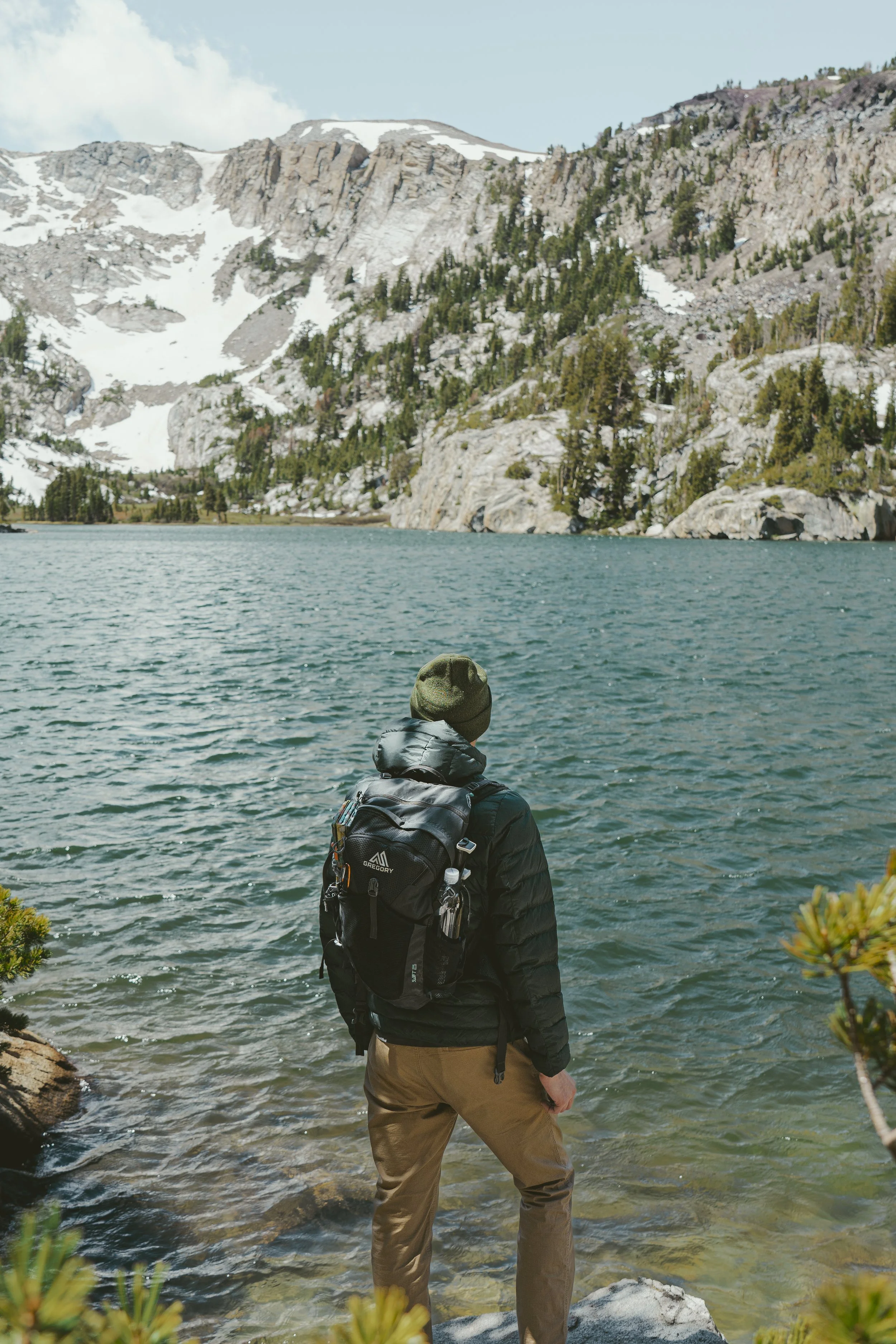
Just a few miles farther, Tenaya Lake is the crown jewel of Yosemite’s high country. This glacially carved lake is ringed by smooth granite slabs and pine forest, making it an ideal spot for a picnic, a swim (if you’re brave, it's cold!), or simply lounging by the water. In spring and early summer, the shoreline is quiet and peaceful, and reflections of the surrounding peaks are crystal clear.

As you descend toward Lee Vining, stop at Whoa Nellie Deli (inside the Mobil gas station) for legendary fish tacos. I know. It’s sounds bizarre. But when I tell you these were some of the best fish tacos I’ve ever had, I’m not joking.
After you fueld up at Whoa Nellie Deli, make sure you swing by Mono Lake South Tufa for a surreal stroll among ancient formations. The Mono Lake Tufas are otherworldly limestone formations that rise from the lake’s salty, alkaline waters, formed by the interaction of freshwater springs and lake minerals over centuries.


The best time to go is truly at sunrise or sunset when the light casts a magical glow on the strange landscape, but it’s a fun adventure no matter what tie of day you make it down there.
Finally, make your way down to Mammoth and check into your lodging. Once you’ve settled in, head to Mammoth Brewing Company for dinner and a local beer.
Day 04: Mammoth Adventures
Start your day with a hike to one of Mammoth’s famous lakes. I recommend Crystal Lake, a trail that offers a rewarding adventure with panoramic vistas and a serene alpine lake destination. Starting from the Lake George Trailhead, this out-and-back trail spans approximately 3 miles round-trip with an elevation gain of about 800 feet, making it a moderate hike suitable for most visitors.
The trail begins with a series of switchbacks, ascending through a shaded forested area. As you climb, take moments to pause and enjoy sweeping views of Lake George, Lake Mary, and the surrounding peaks.
After about a mile, you'll reach a trail junction. Bear left to continue toward Crystal Lake; the right fork leads to the more strenuous Mammoth Crest Trail.
Continuing on, the trail levels out briefly before a gentle descent brings you to the shores of Crystal Lake, situated at an elevation of approximately 9,600 feet. Here, Crystal Crag, a striking granite monolith, towers above the lake, creating a picturesque backdrop.
Looking for a dog-friendly Mammoth Lakes itinerary? Check out my Dog-friendly weekend guide here.

The lake's clear waters and peaceful setting make it an ideal spot for a picnic, photography, or simply relaxing and soaking in the natural beauty. If you’re feeling adventurous you can explore informal paths along the lake's perimeter, but some areas may be rugged or overgrown.
In the afternoon, rent bikes and cruise the Lakes Basin Path, a paved trail that winds past lakes, pine forests, and the jagged Minarets. Mammoth is incredibly bike friendly and it’s such a fun way to see the town. End the day at Minaret Vista, a stunning sunset spot with sweeping views of Ritter Range.
For dinner in Mammoth, you’ve got great options depending on your vibe—Skadi offers an upscale alpine-inspired dining experience with seasonal dishes, while The Village is perfect for something more casual, with plenty of options like pizza, burgers, and après-ski favorites.
Day 05: Mammoth to Los Angeles via Hwy 395
Before heading south, take a sunrise soak at Wild Willy’s Hot Springs, natural pools with epic mountain views. Then stop in Bishop at Schat’s Bakery for legendary bread, pastries, and snacks for the road.

For lunch, you have to hit Copper Top BBQ in Big Pine (get the tri-tip). As you continue down Hwy 395, there are a few more optional stops worth your time:
Manzanar National Historic Site – Just off Highway 395, Manzanar tells the story of one of ten WWII-era internment camps where Japanese Americans were unjustly incarcerated. The site includes a compelling visitor center, reconstructed barracks, and remnants of daily life that offer a sobering but important glimpse into this chapter of American history.
Fossil Falls – A unique geological site off Highway 395 in Owens Valley. While it doesn’t feature active waterfalls, it showcases ancient lava flows shaped by glacial meltwater during the Ice Age. The area is dotted with striking basalt formations, deep potholes, and polished channels, remnants of a once-thriving river. A short trail leads to the main drop-off, offering a fascinating look at the region's natural history.
Red Rock Canyon State Park – A stunning natural gem located in California’s Mojave Desert. Known for its striking red and orange sandstone cliffs, the park offers scenic views, dramatic rock formations, and diverse desert landscapes. Visitors can explore several easy-to-moderate hiking trails, perfect for wildlife spotting and photography. It’s a peaceful stop for those traveling along Highway 14, offering a taste of the desert’s rugged beauty.


So there you have it: The Sierra Circuit. Yosemite’s granite giants, Mammoth’s alpine lakes, and all the weird, wonderful stops along Hwy 395. It’s one of those trips that makes you slow down, breathe deeper, and remember why you fell in love with road tripping (and hiking) in the first place.
If you’re heading out that way, pack the layers, charge the camera, and leave some room in your plans for detours, there is SO much more to see than I could even fit in these 5 days. Happy hiking!
What to pack for your Sierra roadtrip:
Everyday Essentials
National Parks Pass / Entry Fees
Offline Maps (Download them ahead from AllTrails)
Reusable Water Bottle / Hydration Bladder
Snacks + Cooler
Cash / Card / ID
Portable Charger (great for roadtrips and long hikes)
Clothing Layers
Moisture-Wicking Base Layers + Sun Shirt
Warm Fleece or Puffy Jacket (nights can get cold!)
Waterproof / Wind Shell (especially if you do the Mist Trail!)
Hiking Pants + Shorts
Hat + Sunglasses + Gloves
Swimsuit (Hot Springs + lazy river hangs!)
Hiking Boots + Camp Shoes
Hiking Essentials
Daypack
Headlamp
Sunscreen + Bug Spray
First Aid Kit
Map / Compass / Trail App (Alltrails)
Trekking Poles (optional, but great for those steep Yosemite Valley trails)
Extra Socks
How to get Yosemite National Park reservations (Summer 2025)
Day-Use Entry Reservations
From May 24–26, June 15–August 15, and August 30–September 1, a reservation is required to drive into or through Yosemite National Park between 6 a.m. and 2 p.m.
Reservation Release Date: Reservations become available starting May 6 at 8 a.m. PST on Recreation.gov.
Validity: Each reservation is valid for three consecutive days.
Exemptions: You do not need a separate reservation if you have:
A wilderness permit
A Half Dome permit
A reservation for in-park lodging or camping
An organized tour or are using public transportation (e.g., YARTS)
Alternative Entry Times: Visitors without a reservation can enter the park before 6 a.m. or after 2 p.m
Camping & Lodging Reservations
Reservations are essential for all in-park campgrounds and lodging, especially during peak season.
Reservation Platform: Book through Recreation.gov for campgrounds and the Yosemite Hospitality website for lodging.
Camp 4: This walk-in campground requires reservations one week in advance during the peak season (mid-April through October).
Entrance Fees
Regardless of reservations, all visitors must pay the $35 per vehicle entrance fee, valid for seven consecutive days. Alternatively, consider purchasing the America the Beautiful Pass for $80, which grants access to all U.S. national parks for a year.
Will you be adding this roadtrip to your summer plans?! Let me know in the comments if you have questions or suggestions!


